
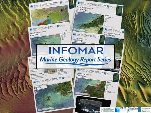
INFOMAR Launches Marine Geoscience Report Series
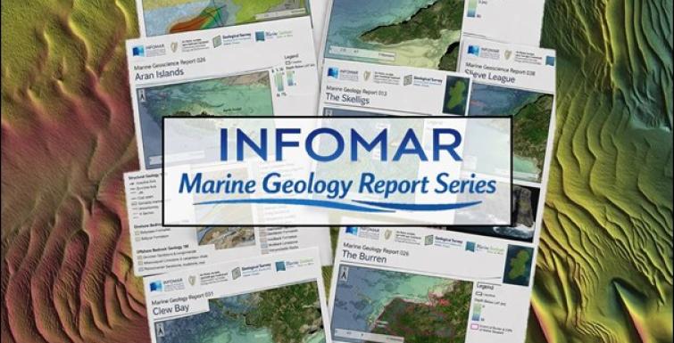
INFOMAR (Integrated Mapping for the Sustainable Development of Ireland’s Marine Resource) is launching the Marine Geoscience Report series; a major new collection of area-focused overview reports that explore the geological character of Ireland’s coastal and offshore waters for a general audience. Developed by INFOMAR using high resolution seabed mapping data and available geological interpretation, the series highlights the landscapes, structures and processes that shape Ireland’s marine territory, from bedrock and glaciation to biodiversity, oceanography and human interaction with the seabed.
INFOMAR is delivering a comprehensive baseline bathymetry dataset to support the sustainable management of Ireland’s marine resource. The new Marine Geoscience Report Series builds on this work by bringing together bathymetry, geology and geomorphology in an accessible report format that reveals how Ireland’s coastal and offshore landscapes have evolved through deep time and continue to change today.
Ireland’s coastline and offshore waters preserve an extraordinary geological archive. Across this new series, readers will encounter drowned glacial landscapes, submerged limestone terraces, ancient volcanic centres, fault-controlled seabed ridges, sandwave fields, sea stacks, karst features, paleocoastlines and bedrock structures that continue from the land far beneath the sea. The reports show that the seabed is not a flat surface, but a complex and dynamic environment shaped by tectonics, sediment transport, glaciation, sea-level change and marine processes.
The series also demonstrates how geology underpins biodiversity, heritage and place. At the Skelligs, for example, INFOMAR bathymetry reveals a submerged bedrock platform marked by fault-controlled ridges and troughs, while the islands themselves combine dramatic Devonian geology with internationally important seabird colonies and the early Christian monastic settlement on Skellig Michael. At Roaringwater Bay and Long Island Bay, the alignment of islands, inlets and reefs follows the folded structure of the Munster Basin, while strong tidal currents generate scour features, sandwaves and other active seabed forms.
Other reports in the series highlight equally compelling stories. The Blasket Islands report traces a landscape shaped by ancient volcanism, terrestrial basin development, later deformation and ongoing marine processes, with contrasting rock types exposed across the archipelago and habitats that support important seabird and benthic communities. The Cliffs of Moher report connects the iconic cliff face with the adjacent seabed, where bathymetry shows rockfall debris and wave-cut platforms that speak to ongoing coastal retreat and the long interaction between stratigraphy, structure and Atlantic wave energy.
The reports also reveal surprising continuity between land and sea. In the Burren, the famous limestone landscape continues offshore as a terraced bedrock platform with joint-controlled pavements, submerged scarps and possible karstic hollows, showing how the geology that shapes this internationally recognised landscape also extends beneath Galway Bay. Around Inishbofin and Inishark, bathymetry captures offshore expressions of structural weakness and faulting, including lineations linked to sea caves and active blowholes, offering a striking example of how marine mapping can illuminate the geological controls behind coastal landforms.
Further along the western seaboard, the Drumlins of Clew Bay report shows one of Ireland’s most distinctive drowned glacial landscapes, where streamlined drumlins continue seamlessly from land into the shallow seabed, creating the bay’s intricate pattern of islands, channels and shoals. Together, examples such as these illustrate the breadth of the Marine Geoscience Report Series and the power of INFOMAR data to reveal geological patterns and processes that are often hidden from view.
The Marine Geoscience Report Series will be released weekly beginning with Roaringwater Bay and Beyond and continuing through a wide range of coastal settings including island groups, estuaries, cliffs, structural headlands, glacial landscapes, sedimentary systems and areas of human interaction with the seabed. Upcoming reports include Islands of Beara, Bantry Bay, Valentia Island, The Skelligs, Inishbofin/Inishark, The Burren, Drumlins of Clew Bay, Waterford Shipping Channel, Tramore Bay, Hook Head, Paleochannels and Cork Harbour. The series offers a new way to explore Ireland’s marine geology, one location at a time.
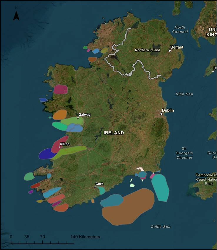
Figure 1: Map showing locations of upcoming INFOMAR Marine Geoscience Reports
INFOMAR will make the series available to the public here. Follow us on social media (LinkedIn, Facebook and Instagram) as each new report is released!
As the series progresses, it will provide an expanding body of accessible geological insight for researchers, students, planners, coastal communities and anyone with an interest in Ireland’s changing marine landscape. Below are some of the upcoming reports.
Weekly release schedule:
Friday 5th June 2026: Roaringwater Bay and Beyond
Friday 12th June 2026: Islands of Beara
Friday 19th June 2026: Bantry Bay
Friday 26th June 2026: Valentia Island
Friday 3rd July 2026: Blasket Islands
Friday 10th July 2026: The Skelligs
Friday 17th July 2026: Inishbofin/Inishark
Friday 24th July 2026: Saltees
Friday 31st July 2026: Old Head of Kinsale
Friday 7th August 2026: Kenmare River
Friday 14th August 2026: Inch Spit
Friday 21st August 2026: Shannon Estuary
Friday 28th August 2026: Loop Head
Friday 4th September 2026: Cliffs of Moher
Friday 11th September 2026: Galway Bay
Friday 18th September 2026: The Burren
Friday 25th September 2026: Aran Islands
Friday 2nd October 2026: Skerd Rocks
Friday 9th October 2026: Kilkieran
Friday 16th October 2026: Drumlins of Clew Bay
Friday 23rd October 2026: Pockmarks in Dunmanus Bay
Friday 30th October 2026: Waterford Shipping Channel
Friday 6th November 2026: St. Patricks Bridge
Friday 13th November 2026: Esker-like Ridges
Friday 20th November 2026: Tramore Bay
Friday 27th November 2026: Hook Head
Friday 4th December 2026: Sandwaves Field
Friday 11th December 2026: Lady's Island Lake
Friday 18th December 2026: Paleochannels
Friday 25th December 2026: Cork Harbour
INFOMAR is funded by the Department Climate, Energy and the Environment and jointly managed by Geological Survey Ireland and the Marine Institute. Through the acquisition, interpretation and release of seabed data, the programme supports marine research, spatial planning, environmental understanding and the sustainable development of Ireland’s marine resource.
Founded in 1845, Geological Survey Ireland is Ireland’s national earth science knowledge centre and a division of the Department of the Environment, Climate and Communications. It provides free and open data and expertise on Ireland’s geology, groundwater, natural resources and seabed.
The Marine Institute is the State agency responsible for marine research, technology development and innovation in Ireland. It provides scientific, advisory and economic development services to support the sustainable management and growth of Ireland’s marine resources.
Please note that the INFOMAR Marine Geoscience Report Series explores the geology and geomorphology of Ireland's coastal and offshore waters through a collection of area-focused reports that draw on high-resolution seabed mapping and geological interpretation. These reports are intended as accessible, high-level overviews for a non-specialist audience and do not seek to provide comprehensive scientific assessments, detailed site investigations or exhaustive reviews of the available literature.


